Fusing L-band ALOS PALSAR radar with C-band RADARSAT-2 acquisitions and POLInSAR coherence modelling enables accurate retrieval of canopy height, stem volume, and Above-Ground Biomass even under year-round cloud cover—delivering audit-grade carbon inventories for forestry and climate markets.
Why Optical-Only Satellite Imagery Struggles in Dense Forests
High-integrity carbon markets require repeatable Measurement, Reporting, and Verification (MRV). Passive optical indices such as NDVI saturate quickly in closed-canopy forests and are frequently obscured for months by tropical and temperate cloud cover.
Synthetic Aperture Radar (SAR) transmits active microwave pulses that pass straight through clouds and interact directly with branches, trunks, and surface moisture.
POLInSAR Coherence & Inverted Water Cloud Modelling in Practice
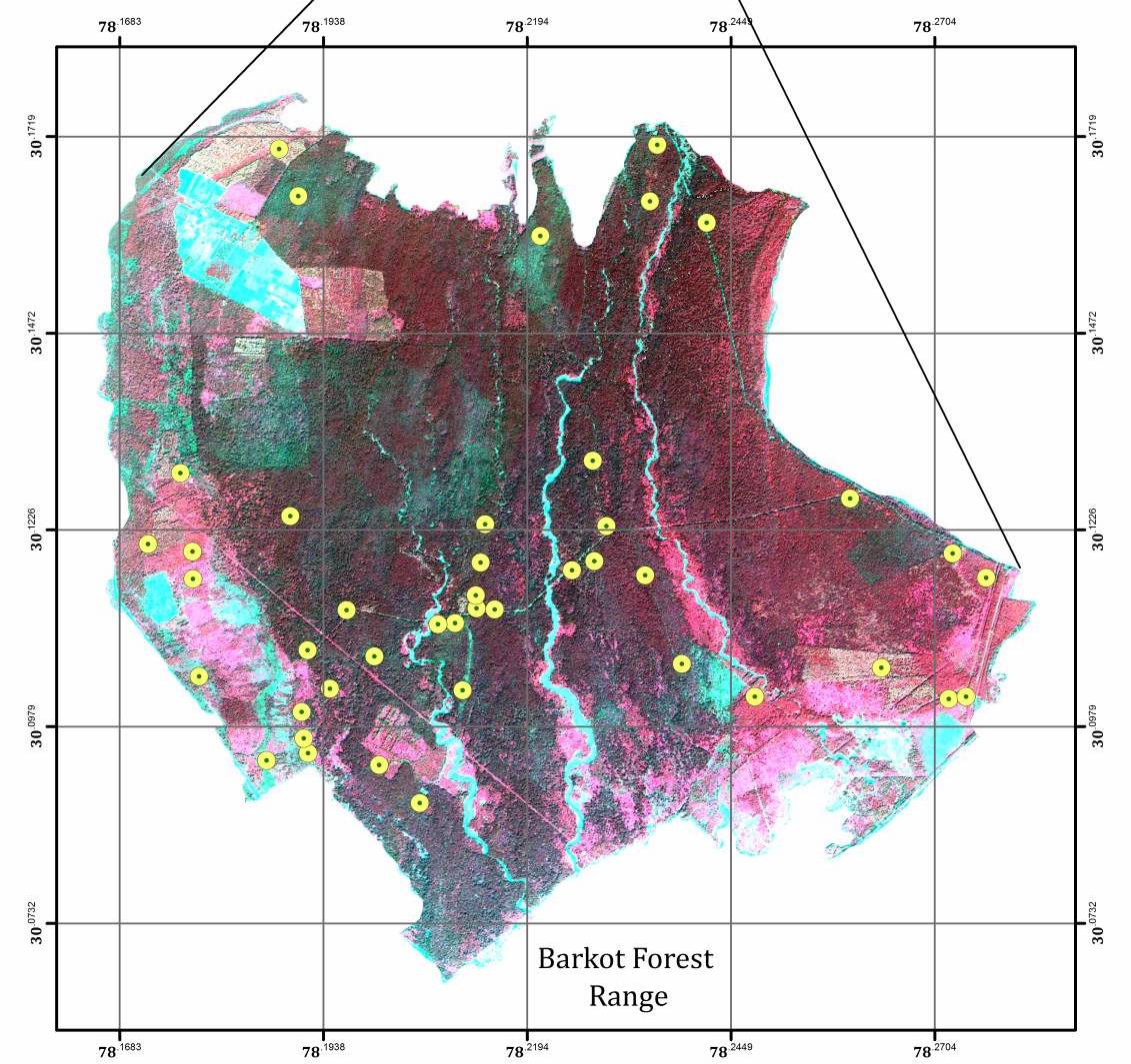
In our Barkot Forest Range research, L-band ALOS PALSAR imagery captured deep sub-canopy structure while RADARSAT-2 provided responsive revisit timing. Applying Polarimetric Interferometric SAR (POLInSAR) coherence inversion alongside the Inverted Water Cloud Model significantly improved tree-height, stem-volume, and biomass accuracy compared with single-sensor regressions.
Combining species-specific wood density with radar-derived structural maps produces spatially explicit carbon sequestration baselines and rapid disturbance alerts.
Complementary Satellite Sensor Modalities in Natural Capital Analytics
| Sensor Type | Cloud Penetration | Canopy Reach | Best Used For |
|---|---|---|---|
| Multispectral Optical (Sentinel-2 / Landsat) | Blocked by cloud | Upper leaf reflectance | Species mapping & crop vigour |
| C-Band SAR (RADARSAT-2 / Sentinel-1) | All-weather | Upper canopy & surface water | Frequent disturbance, crop & flood tracking |
| L-Band Full-Pol SAR (ALOS PALSAR) | All-weather | Deep branch & trunk structure | Dense forest biomass & canopy height |